Sandhan Fm
Type Locality and Naming
OUTCROP. Named after Sandhan village. Overlying the Chhasra Fm, a dominantly sandstone formation which is the highest in the Tertiary sequence of Kutch, has been named as the Sandhan Formation (Source: Pandey and Dave, 1998). [Original Publication: Biswas, S.K. and Raju, D.S.N. (1971) Note on the rock stratigraphic classification of the Tertiary sediments of Kutch Quart. Jour. Geol. Min. met. Soc. India.]
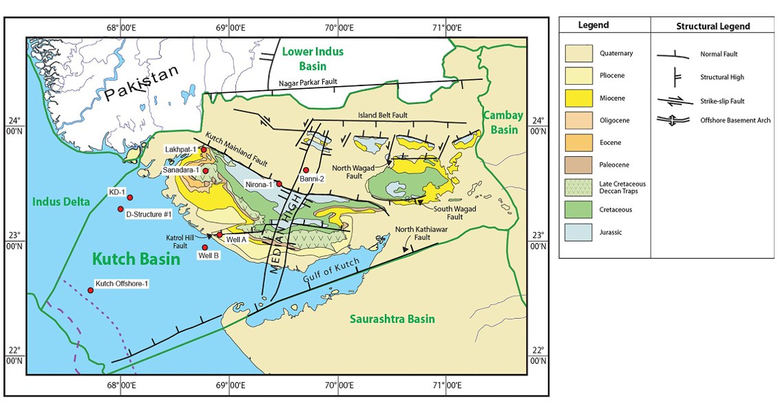
[Fig. Geological and structural map of Kutch, also showing the onshore and offshore wells drilled for oil exploration. (Map by Rasoul Sorkhabi in GeoExpro Dec2014, based on various sources including S.K. Biswas, Current Science, 25May2005)]
Lithology and Thickness
Coarse-grained sandstone. Lower part of the formation consists of well-sorted medium- to coarse-grained, marly, sandstone overlain by clayey/marly laminated siltstone and topped by thin yellow fossiliferous limestone. Middle part comprises of conglomerate and coarse-grained sandstone with lenticular bodies of conglomerate. Upper part consists of hard grits overlain by pink and grey silty sandstone and calcareous nodules. Fossil wood pieces of various sizes occur extensively. In the outcrop is above 290 m and thins out towards west where it is 196 m in Well Banni-2
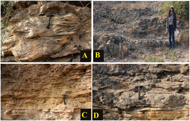
[Figure 1: Outcrop photographs of the upper part of the Sandhan Formation i.e. fluvial facies identified in the field (Facies code according to Miall, 1977). (A.) Trough cross stratified gravel forming gravel bar (Gt). (B.) Sediment gravity flow showing an elongated lobe geometry (Gmm). (C.) Inter-laminated mud, silt and sandstone (Fl). (D.) Floodplain sediment (Fsm) above channel characterized by mud, silt, (Shekhar et al., 2018).]
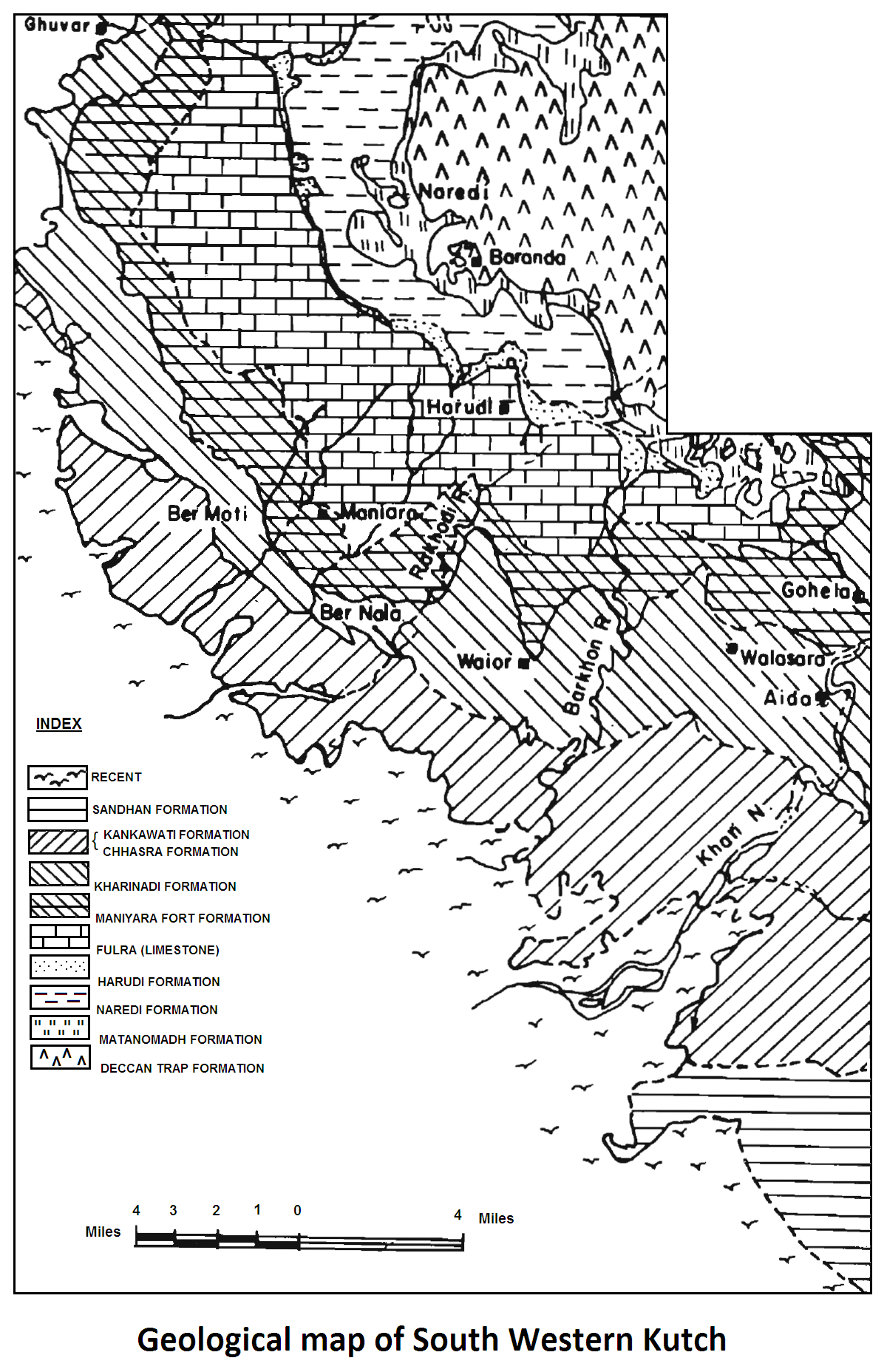
[Figure 2: Geological Map of South Western Kutch]
Relationships and Distribution
Lower contact
The Lower Boundary is disconformable on Kankawathi Fm (early Miocene) or Chassara Fm (middle Miocene) in the outcrops, but in Wells Banni-1 and Nirona-1 the lower boundary is marked based upon log break.
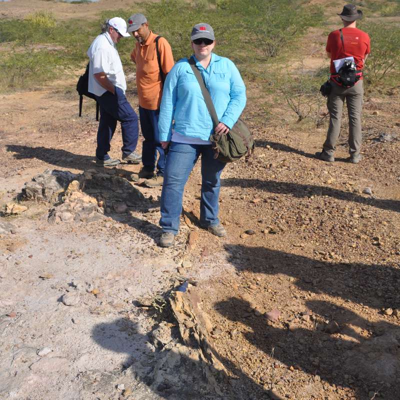
[Fig. Sharp contact of the Pliocene-age Sandhan Formation (mainly grey sandstone containing fossil woods) and the Miocene-age Chhasra Fm (Chassara Fm) (poorly fossiliferous, silty shales of marine shelf deposition) along a disconformity near the village of Mothala on Naliya Road. (Source: Rasoul Sorkhabi in GeoExpro Dec2014)]
Upper contact
The Upper Boundary is not distinct; but presumably locally is overlain by the Milliolite Fm (Pleistocene)
Regional extent
GeoJSON
Fossils
Foraminifera recorded include Ammonia sp., Pararotalia sp., Elphidium sp., fossil wood, Dipterocarpoxylonmalvii, is common in the basal conglomerate. Mathur and Mathur (1969) described 21 species of Spores and Pollen from this formation. Several Vertebrate fossils including Anthracotheroids and Suids have been reported by Prasad (1964, 1967) from this formation (Source: Pandey and Dave, 1998).
Age
Depositional setting
Fluvial to Littoral to Deltaic environment.
The onset of fluvial sedimentation marks the end of the Cenozoic carbonate platform, and therefore, a major shift in depositional setting in the Kachchh Basin. This event coincides with the westward tilt of the basin due to collision of the Indian plate with the Tibetan Plateau, which triggered the initiation of the Himalayas and, consequently, of the proto-Indus river systems.
Additional Information
Sequence Stratigraphy – Second-order sequences (late Miocene - Pliocene)- (After O. Catuneanu, A. Dave, 2017):
The lower boundary of the second-order Mio-Pliocene sequence is well exposed in the Chhasra (Chassara) cliff section, where it is marked by a subaerial unconformity that separates the Early Miocene carbonate platform from the post-Middle Miocene fluvial deposits. The unconformity represents a major truncation surface with irregular relief associated with processes of fluvial incision, most likely triggered by a significant fall in relative sea level.
Following the incision, fluvial sedimentation took place in high-energy gravel-bed and sand-bed braided rivers, as indicated by the presence of downstream-accretion macro-forms, the high degree of channel amalgamation, and the lack of preservation of floodplain facies. The details of the subaerial unconformity show large, sometimes meter-scale rip-up limestone clasts concentrated as lag deposits above the incision surface, providing further evidence for the high energy of this river system. Depending upon the depth of fluvial incision, the sequence boundary may rest on the top of limestone or marl.


